ORACULAR
2022-2024
Oracular
2022-2024
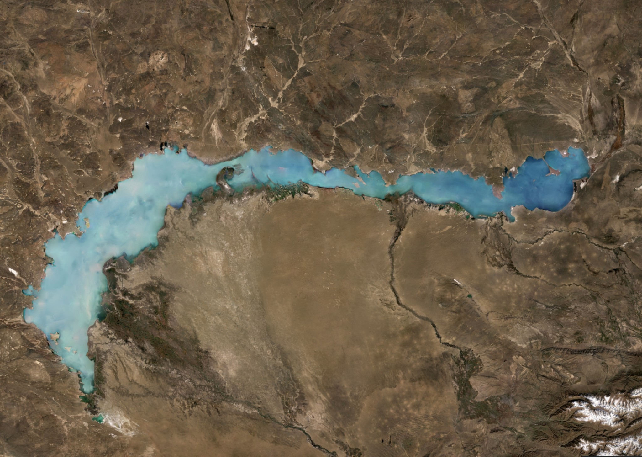
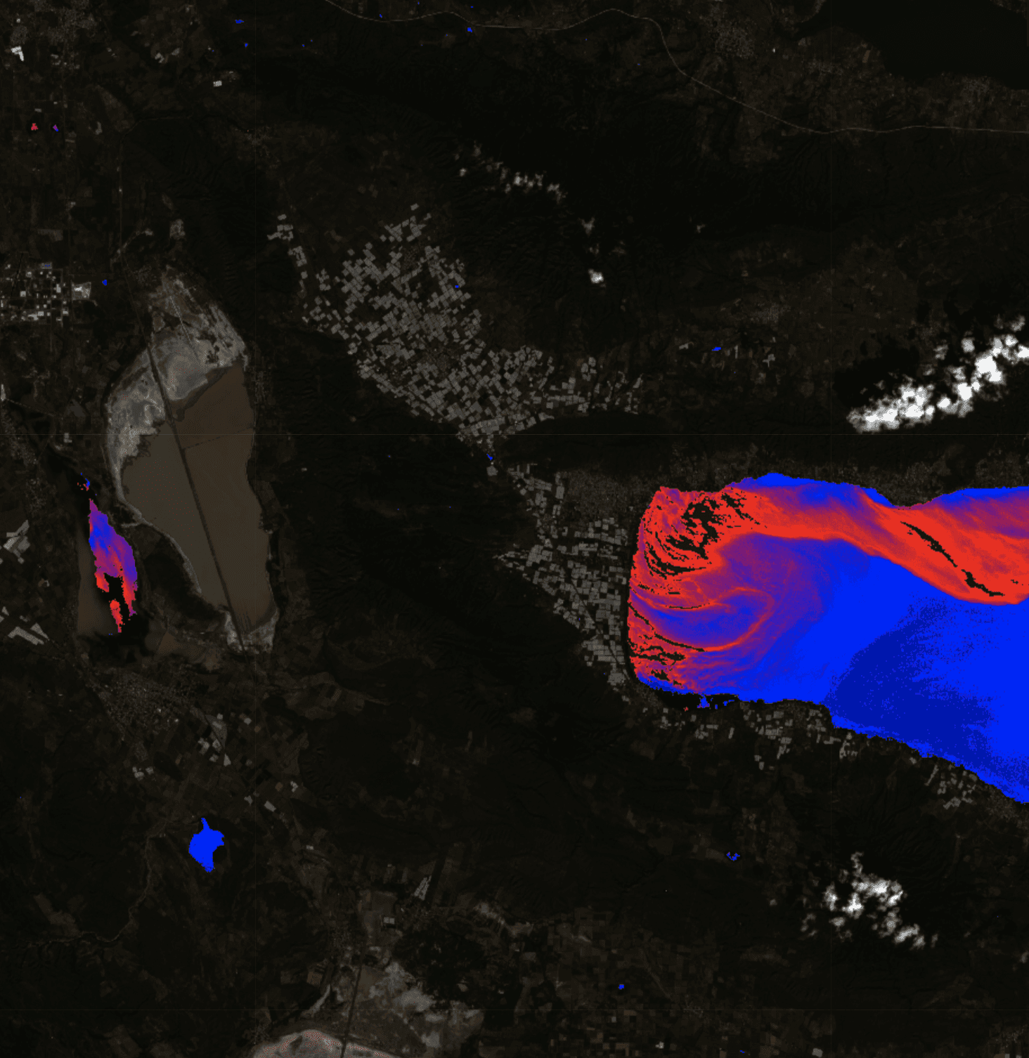
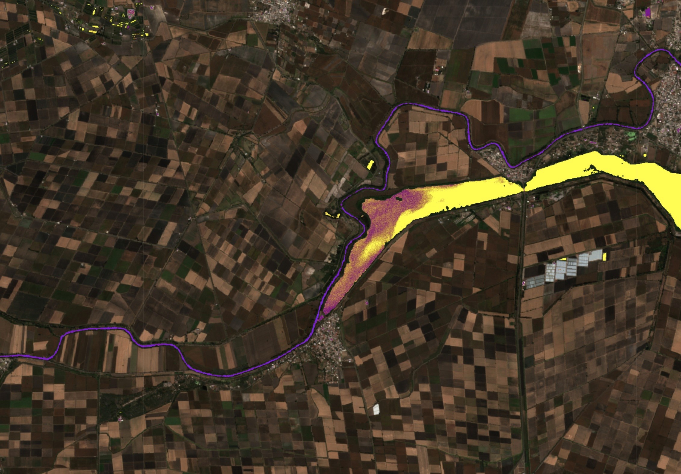
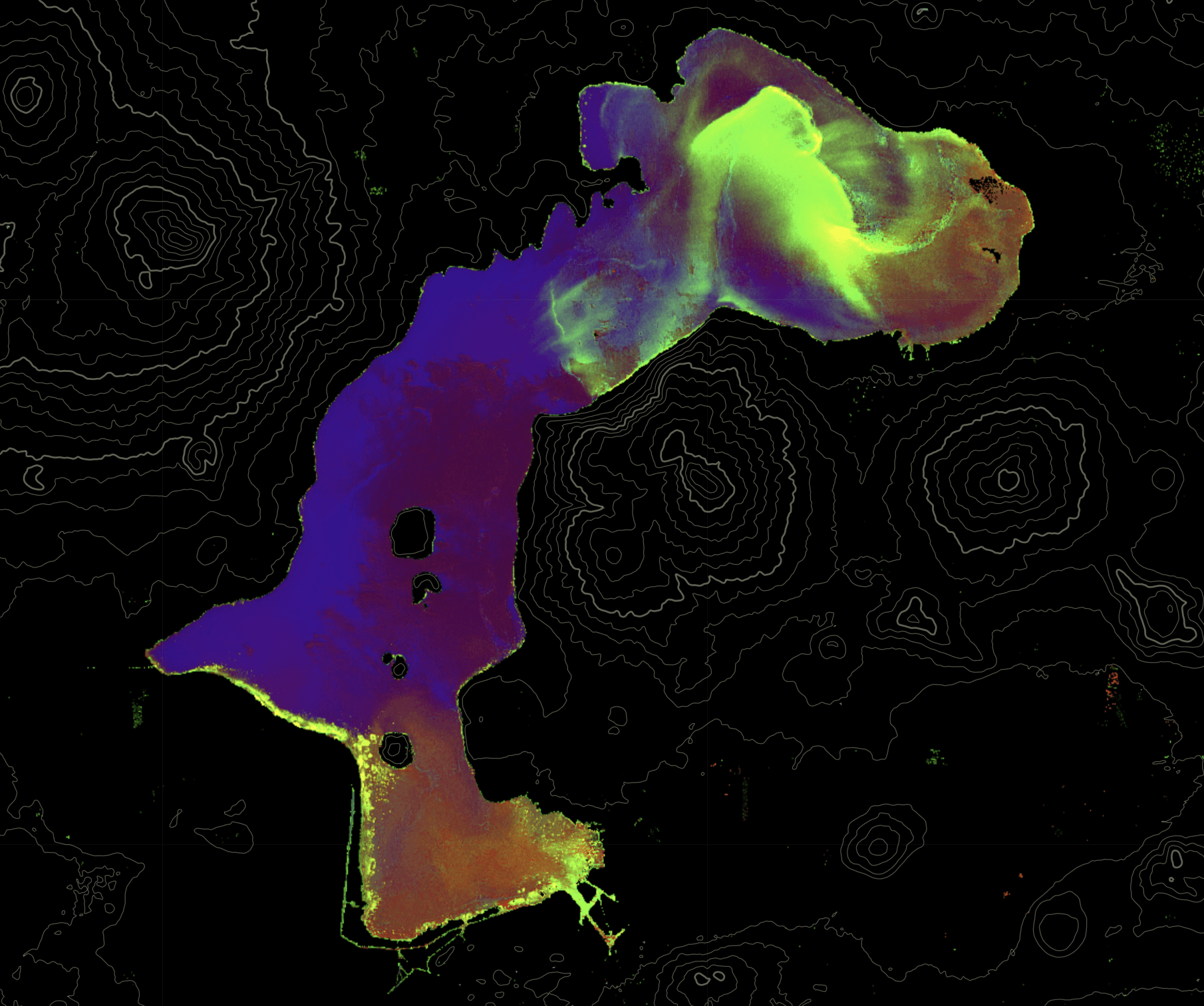
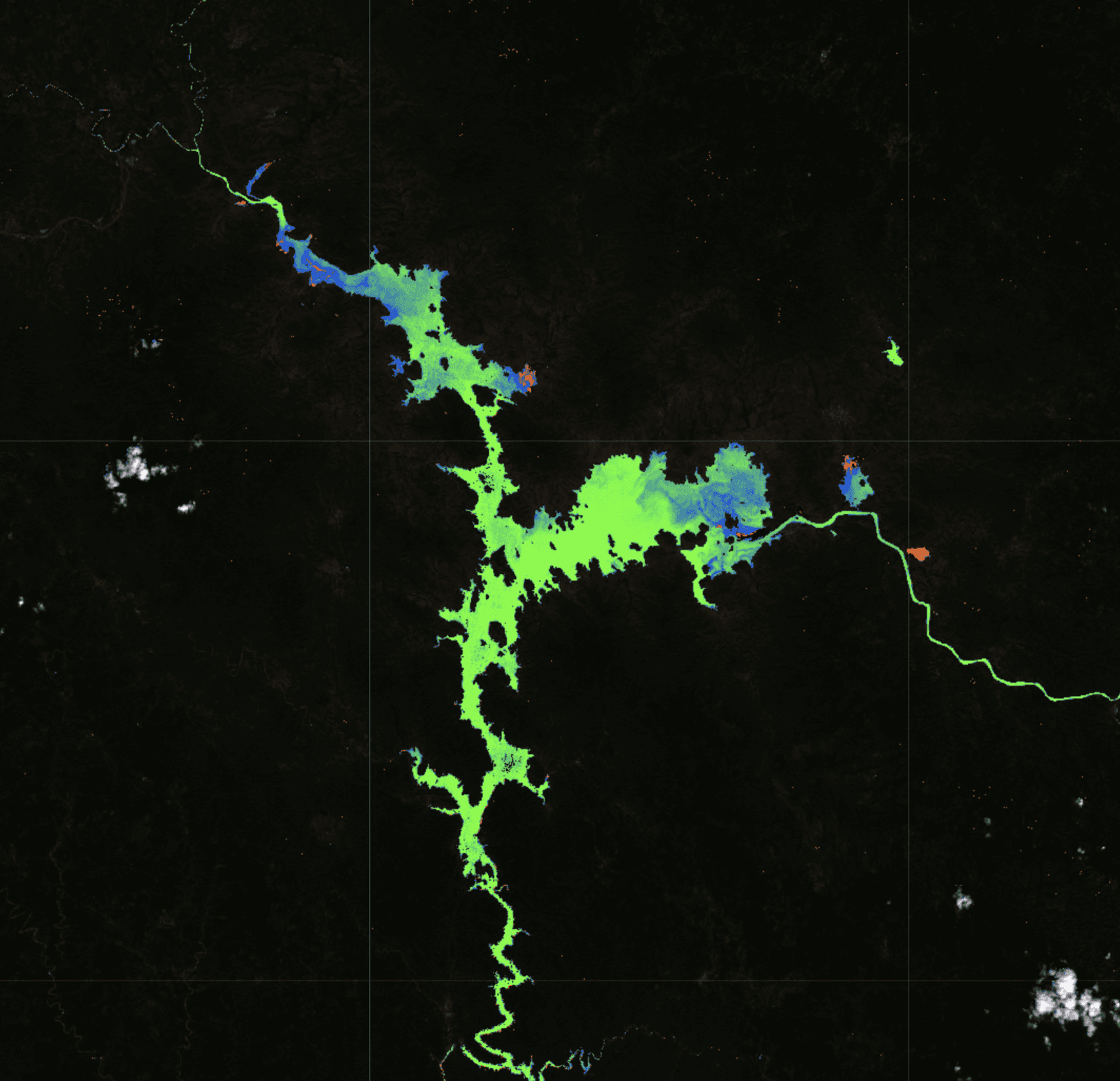
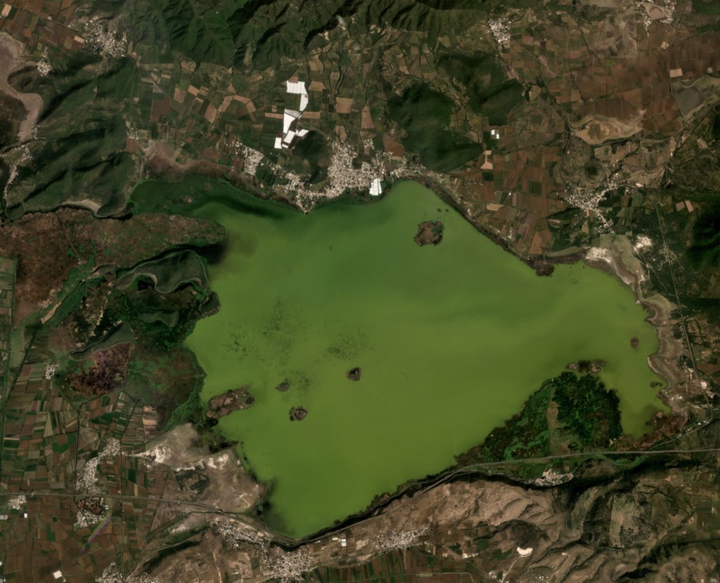
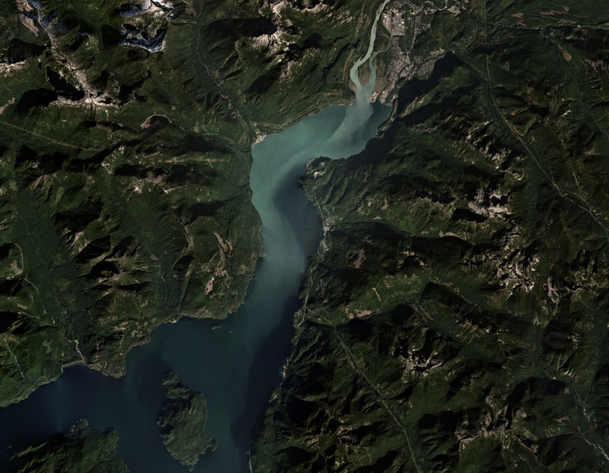
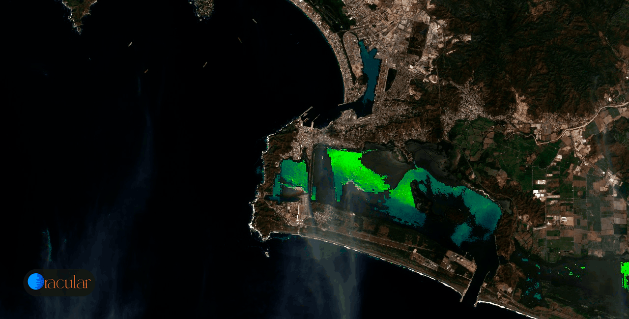
This project is a software system that leverages multispectral satellite imagery to estimate a range of critical environmental parameters, particularly for bodies of water. Thanks to data from Earth observation satellites and field data samples, the software analyzed and monitored critical indicators such as the trophic state of water, turbidity, dissolved oxygen levels, surface temperature, sediment content, harmful algae blooms, total suspended solids and oil spills.
The prototype was designed to simplify the process of tracking large bodies of water over time, making it easier to identify changes and potential risks. A key part of the development involved calibrating the satellite data with field sample measurements, aligning real-world water quality data with the reflectance captured in the imagery. This calibration process ensures that the software's estimates are as accurate as possible with a high correlation using linear and multivariable regressions. By automating the analysis, it reduced the need for constant fieldwork and enables quicker responses to environmental issues, like the early detection of harmful algae blooms. With this knowledge I provided case studies to entities of the Mexican government and collaborated with high profile international organisations. This project was selected by the Planet Startup Program 2023-2024.
Special thanks to: Mares de Mexico, Dear Wise Earth and Planet Labs.
Software development, satellite data pipeline, UX UI, Remote sensing research